Page last updated Mon 1 Sep 2025
Aiden observed storm force winds
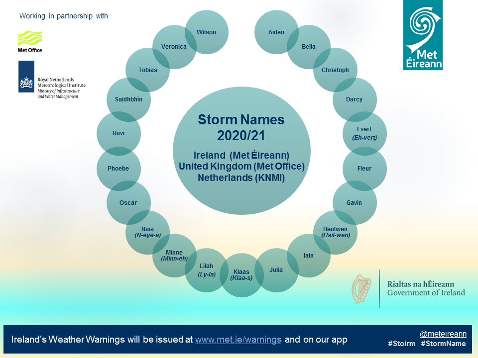
There were six named storms during the 2020/21 storm season, which ran from Tuesday 1 September 2020 to Tuesday 31 August 2021 (inclusive). The 2020/21 storm season was quieter than 2019/20 but still produced a mix of storms during holiday events (Halloween and St. Stephen's Day).
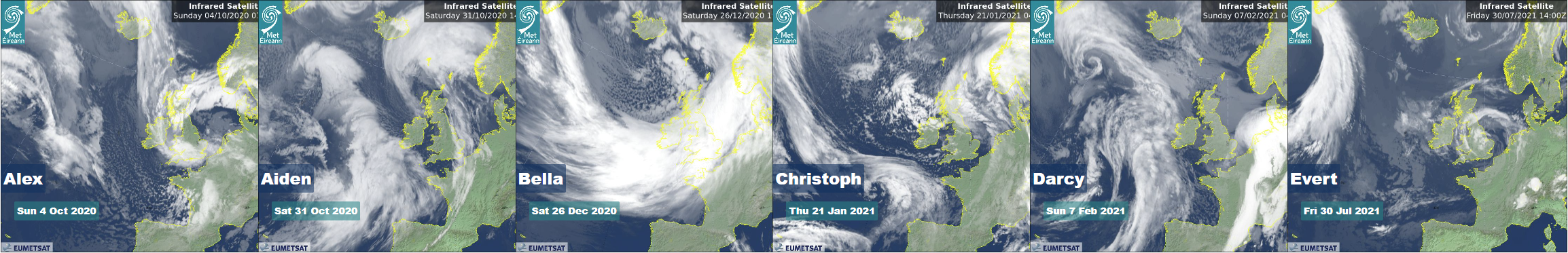
It began with Alex in early October, with heavy rain in County Wicklow (73 mm) and 10.7 m waves off County Donegal, though winds stayed in the gale range. By Halloween, storm force Aiden was gusting 130 km/h. On St. Stephen’s Day, Bella brought gusts to 122 km/h at Mace Head, a deep 961 hPa low at Malin Head and a huge 20 m wave out at buoy M6 in the deep Atlantic.
In January, Christoph was more about cold air and rain than extreme wind for Ireland, with near-gale force winds and almost 10 m waves recorded off County Donegal. Then in early February, Darcy brought a short burst of cold easterly gales, gusts of 83 km/h and waves above 12 m in the deep Atlantic. In July, Evert appeared as a summer storm, producing strong breeze conditions at the coast but heavy rainfall in County Waterford (46 mm).
| Name (Named by) Peak Impact Date |
Highest sustained wind speed (km/h) | Highest gust wind speed (km/h) | Highest daily rainfall total (mm) | Daily air temperatures (°C) | Lowest mean sea level pressure (hPa) | Highest individual wave (m) | |
|---|---|---|---|---|---|---|---|
- |
Alex (Météo France) Sun 4 Oct 2020 |
Gale Force 74 km/h (40 knots | 46 mph) Roches Point (coastal), Co Cork around 2pm |
100 km/h (54 knots | 62 mph) Roches Point (coastal), Co Cork at 1:46pm |
73.1 mmM.duff Hill, Co Wicklow | 3.3°C at Carrickmacross, Co Monaghan to 16.8°C at 2 stations in Cork and Mayo | 983.0 hPa Dublin Airport, Co Dublin around 9am and 10am and Sun 4th |
10.7 m Buoy M4 (off Donegal coast) around 5pm |
|
AIDEN (Met Éireann) Sat 31 Oct 2020 
|
Storm Force 98 km/h (53 knots | 61 mph) Malin Head (coastal), Co Donegal around noon |
130 km/h (70 knots | 81 mph) Malin Head (coastal), Co Donegal at 12:57am |
33.5 mmGlencar (Dreenagh), Co Kerry | 2.3°C at Carrickmacross, Co Monaghan to 16.2°C at Merrion Square, Co Dublin | 978.7 hPa Belmullet (coastal), Co Mayo around 6am |
12.8 m Buoy M3 (off Cork coast) around 11am |
|
|
BELLA (Met Office) Sat 26 Dec 2020
|
Gale Force 85 km/h (46 knots | 53 mph) Mace Head (coastal), Co Galway around 2am and 7pm |
122 km/h (66 knots | 76 mph) Mace Head (coastal), Co Galway at 9:23pm |
59.5 mmMaam Valley, Co Galway | -0.4°C at Ballincurrig (Peafield), Co Cork to 12.0°C at 2 stations in Clare and Cork | 961.2 hPa Malin Head (coastal), Co Donegal around 10pm Sun 27th |
20.0 m Buoy M6 (in the deep Atlantic) around 3am |
|
|
Christoph (Met Office) Thu 21 Jan 2021 |
Near Gale 56 km/h (30 knots | 35 mph) Malin Head (coastal), Co Donegal around 6am |
78 km/h (42 knots | 48 mph) Malin Head (coastal), Co Donegal at 6:35am |
13.2 mmCreeslough (Brockagh), Co Donegal and Gweedore Weir, Co Donegal Fri 22nd and Fri 22nd | -3.8°C at Carrickmacross, Co Monaghan to 10.0°C at Dooks, Co Kerry | 973.8 hPa Malin Head (coastal), Co Donegal around 3am |
9.8 m Buoy M4 (off Donegal coast) around 6am Fri |
|
|
Darcy (KNMI) Sun 7 Feb 2021 |
Gale Force 69 km/h (37 knots | 43 mph) Malin Head (coastal), Co Donegal around 3am |
83 km/h (45 knots | 52 mph) Malin Head (coastal), Co Donegal at 3:26am |
9.5 mmCoomclogh, Co Cork | -1.6°C at Gurteen, Co Tipperary to 9.5°C at Glengarriff (Ilnacullin), Co Cork | 1002.1 hPa Sherkin Island (coastal), Co Cork around 0am Tue 9th |
12.1 m Buoy M6 (in the deep Atlantic) around 11pm Mon |
|
|
Evert (Met Office) Fri 30 Jul 2021 |
Strong Breeze 46 km/h (25 knots | 29 mph) Roches Point (coastal), Co Cork and Malin Head, Co Donegal around 1pm and 3am and Thu 29th |
57 km/h (31 knots | 36 mph) Roches Point (coastal), Co Cork and Malin Head, Co Donegal at 1:58pm and 2:25am and Thu 29th |
46.0 mmCrohaun Hill (Commeragh Mountains), Co Waterford Thu 29th | 8.4°C at Horseleap, Co Offaly to 21.8°C at Glengarriff (Ilnacullin), Co Cork | 1001.8 hPa Malin Head (coastal), Co Donegal around 1am Thu 29th |
6.2 m Buoy M5 (off south Wexford coast) around 3am |
|